In the previous two parts, we explored the concept of GIS, the main components of the system, as well as some basic applications of GIS in everyday life. In this section, we will focus on more advanced concepts to help you better understand how GIS works and how to make the most of this tool.
Learn more: Geographic Information System (GIS) – Part 1
Learn more: Geographic Information System (GIS) – Part 2
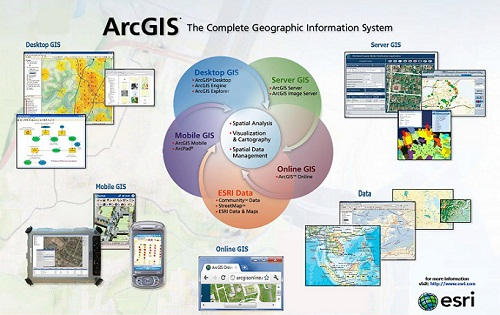
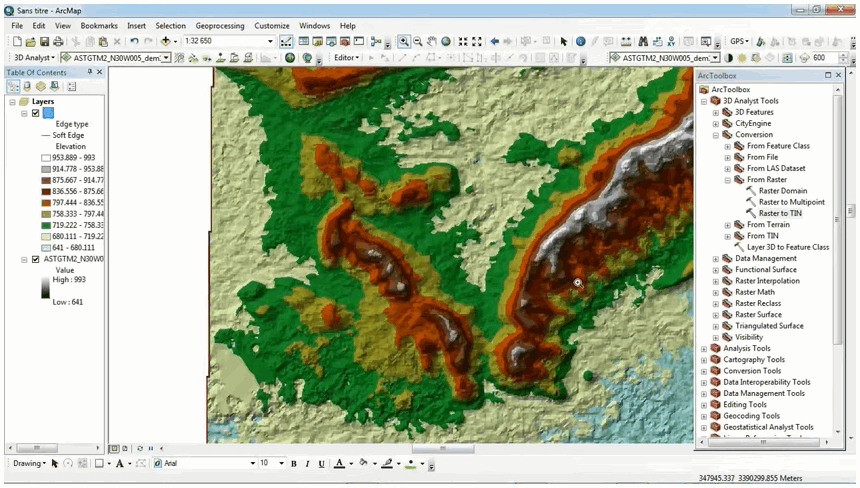
Learn more: ArcGIS Software
With the wide variety of GIS software available today, Esri’s ArcGIS has established itself as a leading solution thanks to its adaptability and continuous innovation. The transition to a cloud-based platform and the integration of high-resolution satellite data from Planet Labs have provided users with a powerful and flexible tool. ArcGIS is not simply a piece of software; it is a comprehensive platform that opens up new possibilities for analyzing and applying geographic data across many different fields.
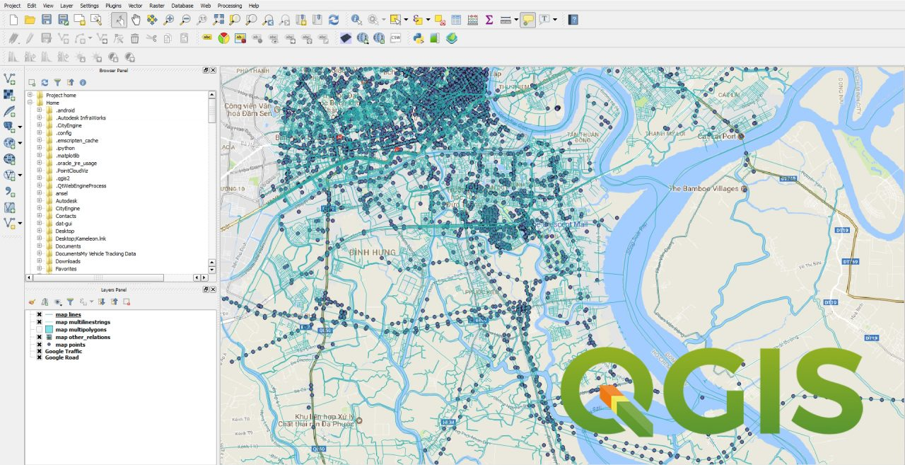
Learn more: QGIS Software
QGIS is a leading open-source GIS software widely trusted by users around the world thanks to its rich features and high level of customization. The open-source nature of QGIS not only helps reduce costs but also encourages creativity and knowledge sharing within the global GIS community, contributing to the continued development of GIS technology.
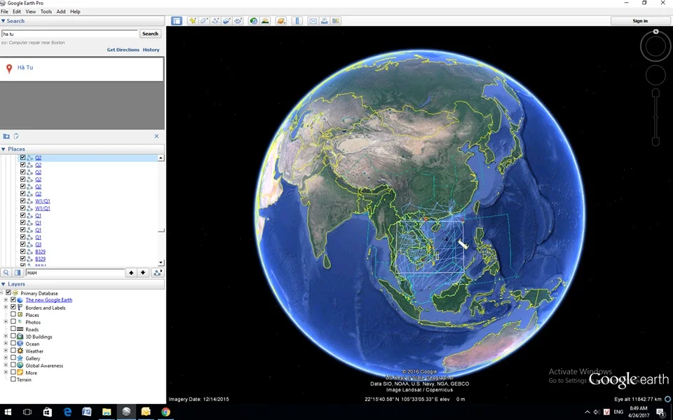
Learn more: Google Earth Pro Software
Google Earth Pro is a powerful geographic visualization application that provides high-resolution satellite imagery and detailed 3D models. The tool supports basic GIS data import and export; however, its advanced analytical capabilities are somewhat limited.
For more complex analyses, Google Earth Engine is a more suitable option, offering programming capabilities and the ability to process large volumes of geospatial data.
Learn more: Tellus Software
Tellus OS, a leading online platform from Japan, is a vast repository of geospatial data. With its extensive collection of high-resolution multispectral satellite data—one of the largest satellite data repositories in the world—along with exclusive mobility datasets, Tellus OS provides deep insights into human behavior and geographic phenomena.
A powerful set of analytical tools, including image classification, object detection, and spatial modeling, transforms accurate and detailed geospatial data into valuable information, supporting strategic decision-making across many fields.
The R programming language has established itself as a leading tool for statistical analysis with a large global user community. Its flexibility and high level of customization make R an ideal choice for geospatial analysis.
The R community has developed a wide range of specialized packages, from basic data manipulation to complex spatial statistical analysis, spatial modeling, and visualization.
For example: basic data manipulation packages allow users to easily create, edit, and perform operations on geometric (vector) objects such as points, lines, and polygons.
Python, with its vibrant user community and rich ecosystem of libraries, has become a popular programming language in many fields, including data science and geographic information systems.
The flexibility and openness of Python make it a powerful tool for geospatial analysis. The ecosystem of Python libraries for GIS continues to grow, providing comprehensive solutions for geographic problems—from data collection and processing to spatial analysis, visualization, and modeling.
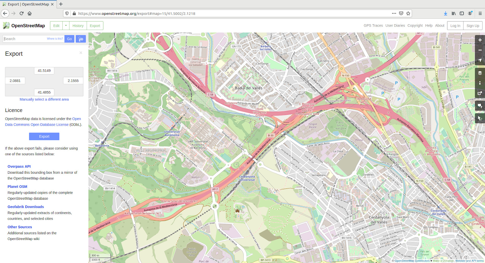
Learn more: Open Street Map (OSM)
OpenStreetMap (OSM) is a unique global community mapping project where anyone can freely contribute to and use geospatial data. With its open and community-driven spirit, OSM has built the world’s largest open geographic database, continuously updated by a diverse and enthusiastic community of users.
OSM data can be integrated into web mapping applications, GIS software such as QGIS, or mobile applications to create interactive maps. These maps can serve many purposes, from urban planning and environmental monitoring to navigation and mobile application development.
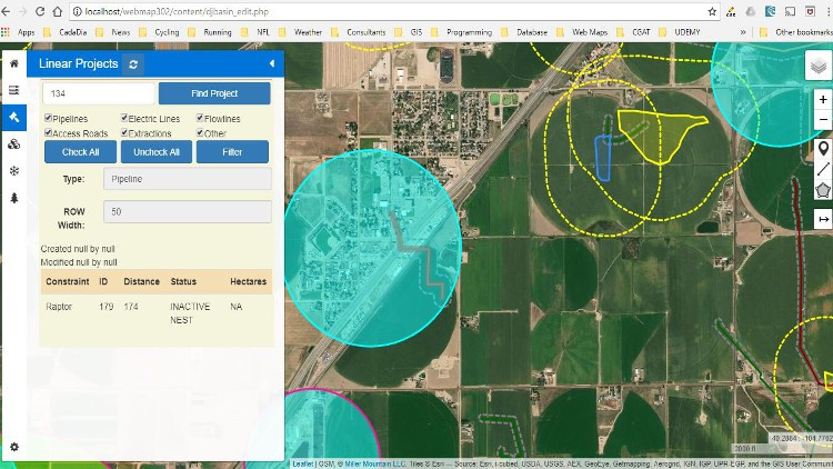
Learn more: Leaflet
Leaflet, a well-known open-source JavaScript library, is a leading choice for building interactive mapping applications. With its lightweight size and high performance, Leaflet provides a solid platform for creating highly customizable web mapping applications.
Thanks to its intuitive Application Programming Interface (API) and comprehensive documentation, Leaflet has become an essential tool for many developers. With a rich ecosystem of plugins, Leaflet also allows developers to easily customize and extend functionalities, meeting a wide range of user needs.
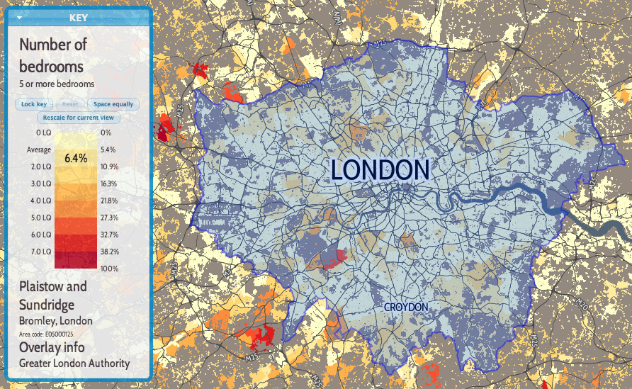
Learn more: OpenLayers
OpenLayers, a powerful open-source JavaScript library, is a leading choice for GIS developers who want to build highly customizable and high-performance web mapping applications.
With its flexible modular architecture, OpenLayers allows developers to easily customize and extend functionalities, meeting the diverse requirements of complex GIS projects. It also supports many open standards such as WMS, WFS, and WMTS, and allows integration with various online mapping services.
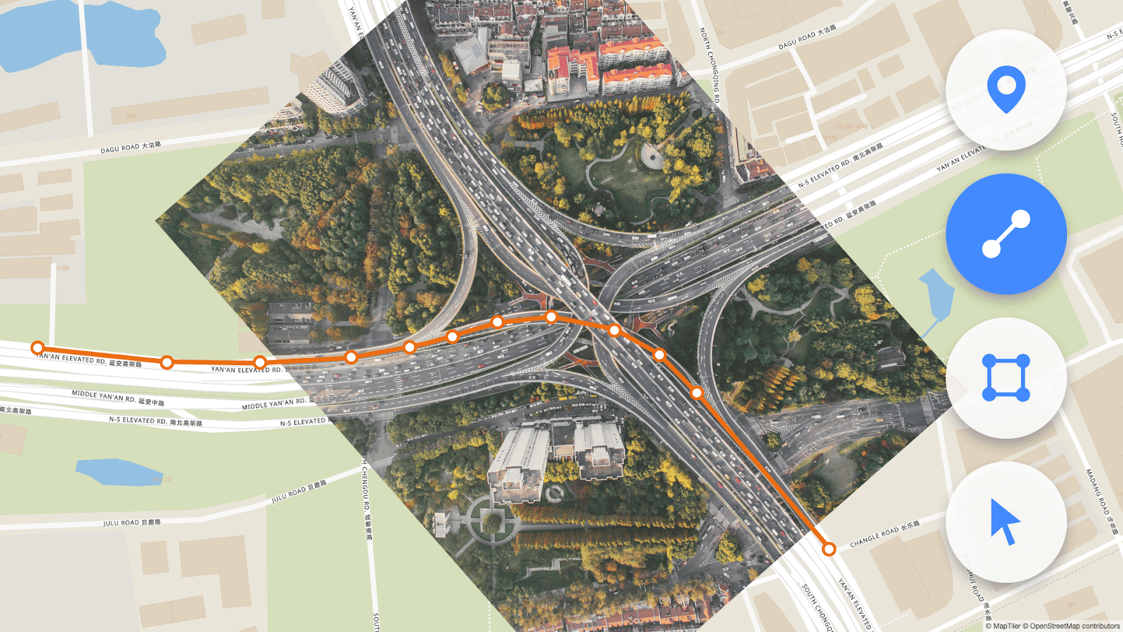
Learn more: MapTiler
MapTiler is a leading online mapping service that provides high-quality and highly customizable map datasets. Developed by Klokan Technologies in Switzerland, MapTiler offers a range of powerful tools for creating custom maps, from style editing to building customized data layers.
In Japan, MIERUNE Co., Ltd. has localized MapTiler map data by combining it with Japan’s open data sources, including topographic data, place names, and transportation infrastructure, to create a map product optimized for the Japanese market.
Notably, the ability to provide map data in vector formats such as GeoJSON makes MapTiler an ideal solution for applications requiring high accuracy, such as urban planning, environmental monitoring, and spatial analysis.
Learn more: Mapbox
Mapbox, one of the world’s leading providers of cloud-based mapping solutions, officially entered the Japan market in 2019. Through a strategic partnership with Zenrin, Mapbox successfully localized its products and services—including geographic data and user interfaces—to meet the growing needs of Japanese users.
With advanced web mapping technology, Mapbox continues to innovate by providing flexible APIs and cross-platform SDKs. These tools allow developers to easily integrate mapping features into their applications, ranging from place search and route planning to geospatial data visualization.
GIS has become an indispensable tool in many areas of life, from science to business. With the continuous advancement of technology, GIS is becoming increasingly powerful and easier to use. Mastering the fundamental concepts of GIS enables users to fully leverage the potential of geographic data, make informed decisions, and contribute to the sustainable development of communities.
The future of GIS is highly promising with the development of new technologies such as artificial intelligence (AI), machine learning, and the Internet of Things (IoT). GIS will continue to play an important role in addressing global challenges such as climate change, urban management, and sustainable development.
Are you facing challenges in implementing Autodesk Revit, BIM, CDE, or any technology and engineering aspects related to BIM for your project?
Don’t worry — BIMCAD Vietnam is always ready to support you!